
AWARD OF EXCELLENCE
Represents unparalleled advancement of the profession of landscape architecture.

Seven Greenways Vision Plan
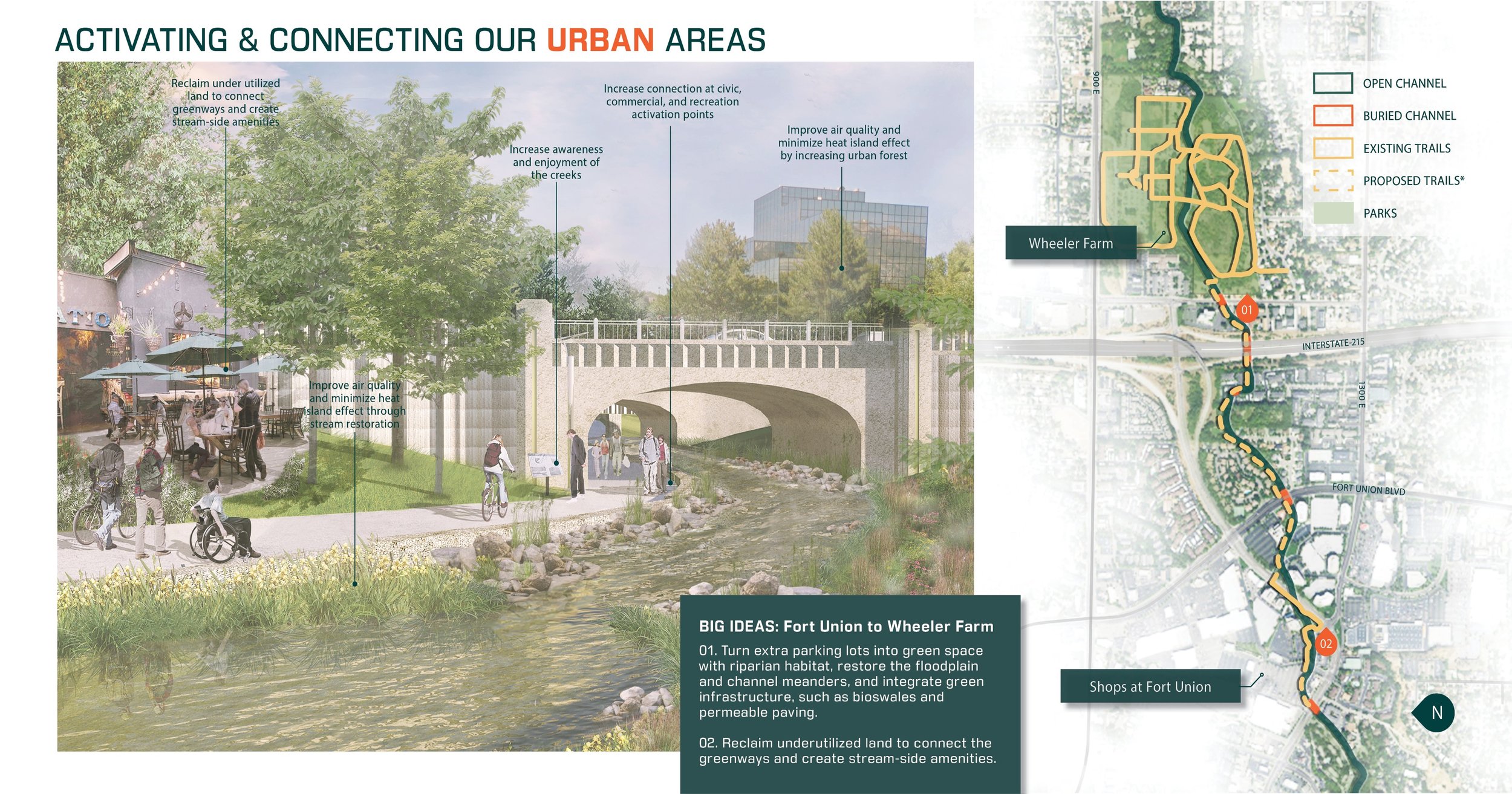
The Salt Lake Valley is facing an exciting future—a connected system of greenways that celebrate water resources. The plan outlines goals, opportunity areas, and big ideas for each core element of ‘water’, ‘nature’, ‘community’, ‘recreation’, and ‘urban’. This includes the revitalization of streams, enhanced bicycle and pedestrian infrastructure, catalyzed economic activity, increased climate resiliency, improved wildlife habitat, providing places for people to experience nature, and opportunities to learn about and enjoy the water.

REGIONAL SOLUTIONS: Improvements and policies focused on the creek corridors collectively provide solutions to regional issues such as loss of riparian habitat, urban flooding and water scarcity, which are increasingly critical to address in the arid environment
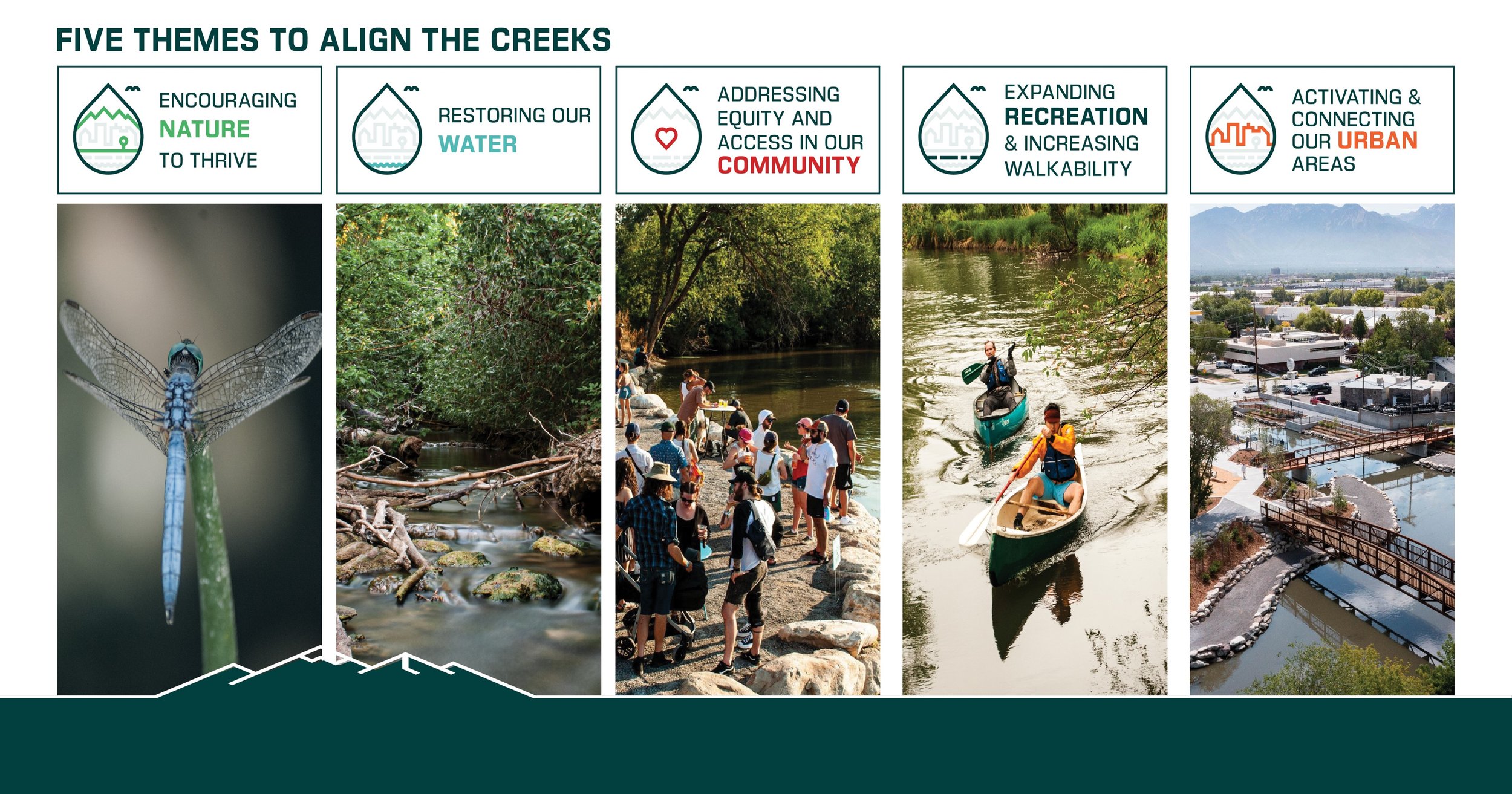
SUMMARY
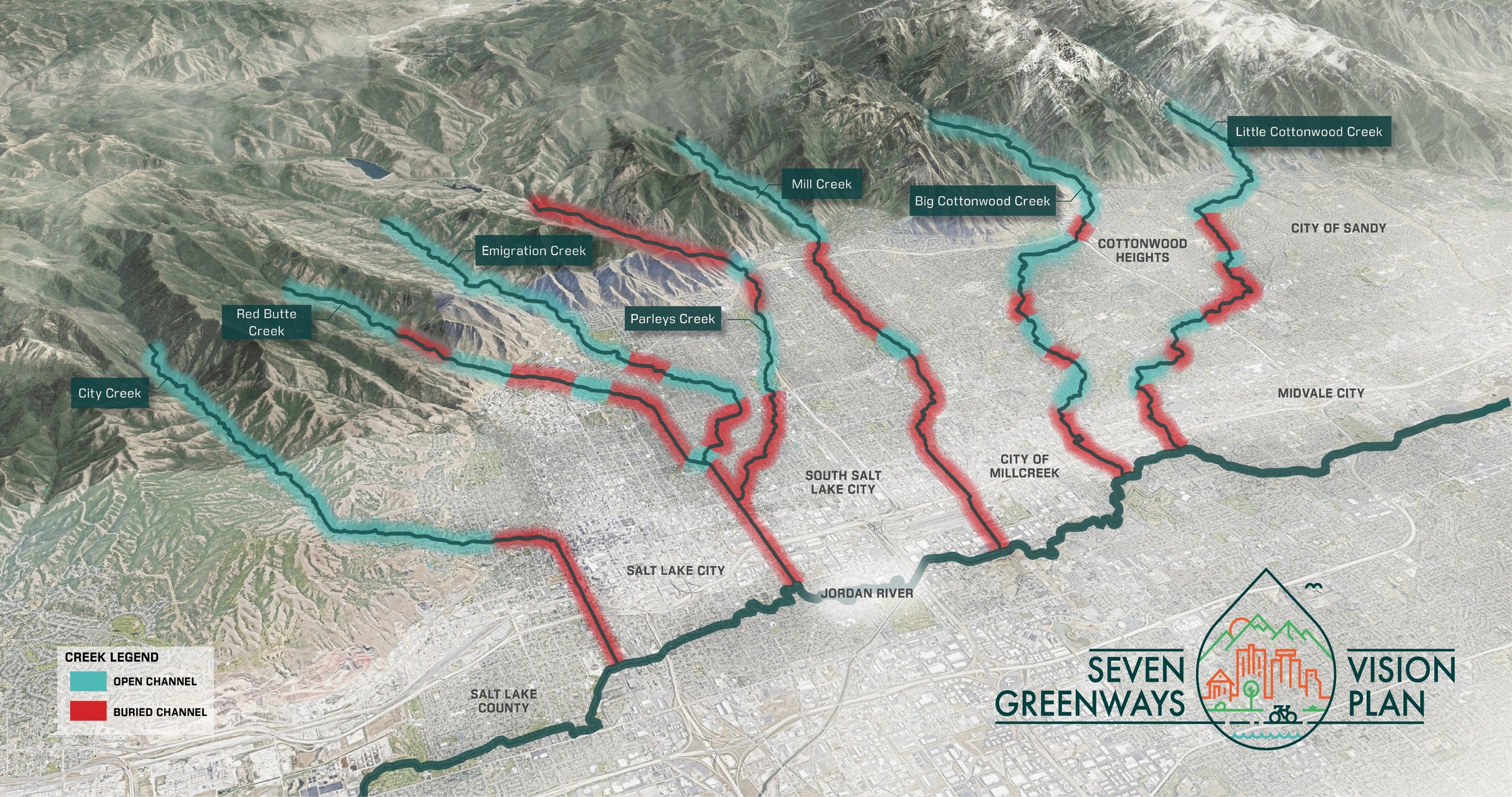
The Great Salt Lake was recently predicted to disappear in five years, which imperils ecosystems and exposes millions of people to toxic dust from the drying lakebed. This warning increases urgency for solutions in the face of the region’s megadrought. This is the first regional plan for upstream resources and focuses on the most populous and rapidly urbanizing area of Utah. The plan inspires shared aspirations for a 100-year vision to revitalize 129 miles of waterways and connect people through greenways flowing from the Wasatch Range.
Unity in approach and widespread support were key goals, as past spot-treatment projects have been piecemeal attempts that do not address complex challenges and interrelated issues. The plan creation process is celebrated as a model for collaborative solution-finding for large landscapes, including nine municipal partners and engagement of thousands of community members and technical experts. The Seven Greenways Vision plan represents hope, with actionable steps for climate resilience, improved wildlife habitat and water quality, connecting people to nature, and the enjoyment of water in an oasis on desert’s edge.
TRANSFERABLE LESSONS FOR LARGE-LANDSCAPE RESOURCE CONSERVATION
This project represents a path forward for approaching water crisis and rapid urbanization of natural habitats. The depth of analysis for environmental, social/cultural, built-environment, economic, recreation, and ecological systems conducted in this study exemplifies the usefulness of the landscape architecture profession for synthesizing desperate data to inform decision-making. Map visualizations were an extremely useful tool for connecting ideas across geographies and made concepts relatable to individuals.
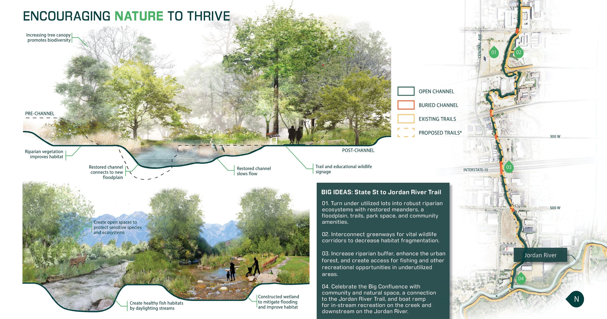
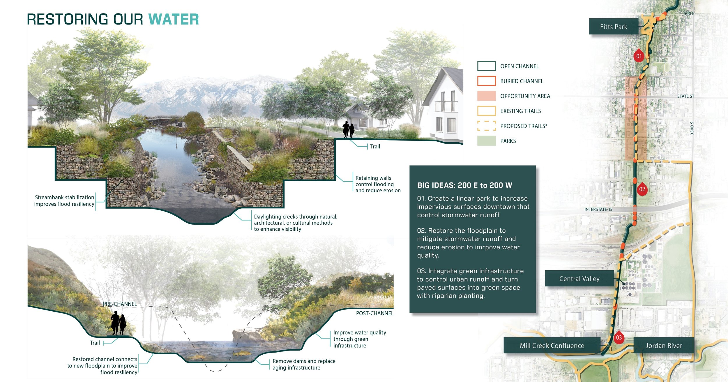
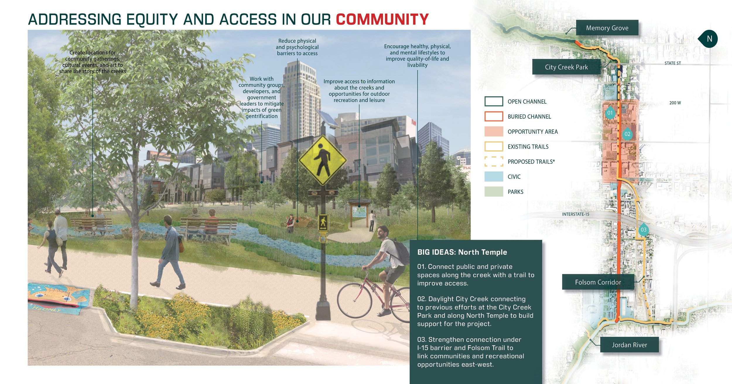
The plan document’s “toolbox” guides municipalities, land managers, and organizations in the creation of greenways, including design guidelines, best management practices, policy guidance, and funding source and suggested partners identification. Illustrations for the corridor design guidelines and best management practices fill a regional need for consistent communication of expectations for varying urban, neighborhood, green space, and canyon conditions. Much of the toolbox’s guidance is transferable to other arid mountain communities.